In July of 2019, we headed north from our home in southern California to claim a
reservation we'd made for a cabin with bath in Yosemite National Park. Procuring
such a reservation is not an easy thing to do, as demand for such accommodations
far exceeds the supply, and one must reserve a year in advance or be extremely
lucky to get into one of these luxurious units. Our reservation was actually two
years in the making, and our luck in the process was both good and bad. Good
because we were able to get the reservation, and bad because our reservation was
originally for 2018 but had to be cancelled, because several wildfires plagued
California in 2018, and one of these had resulted in the closing of the park to
visitors for an extended period that included the time of our reservation. But
we were able to move our reservation to the following year, and when our time
finally came up, the park had managed to not catch on fire, so we loaded
ourselves and our stuff in the car and headed north.
Yosemite is a decent-sized national park, with an area approaching that of the
state of Rhode Island. It's located about 200 miles due east of San Francisco,
a fact which might help you visualize where the park is, but which was of little
interest to us, as we weren't driving from San Francisco. We were coming from
Southern California, and for us the drive was about 350 miles, mostly northward
but a little bit westward (due to California's odd shape, the eastern border of
the north half of the state is actually longitudinally west of Los Angeles).
The trip involved passing through California's central valley, a mainly
agricultural area which is typically blazing hot in the summer (no exception for
us; the temperature hit 107 as we were passing through Fresno).

California with National Parks

Yosemite National Park
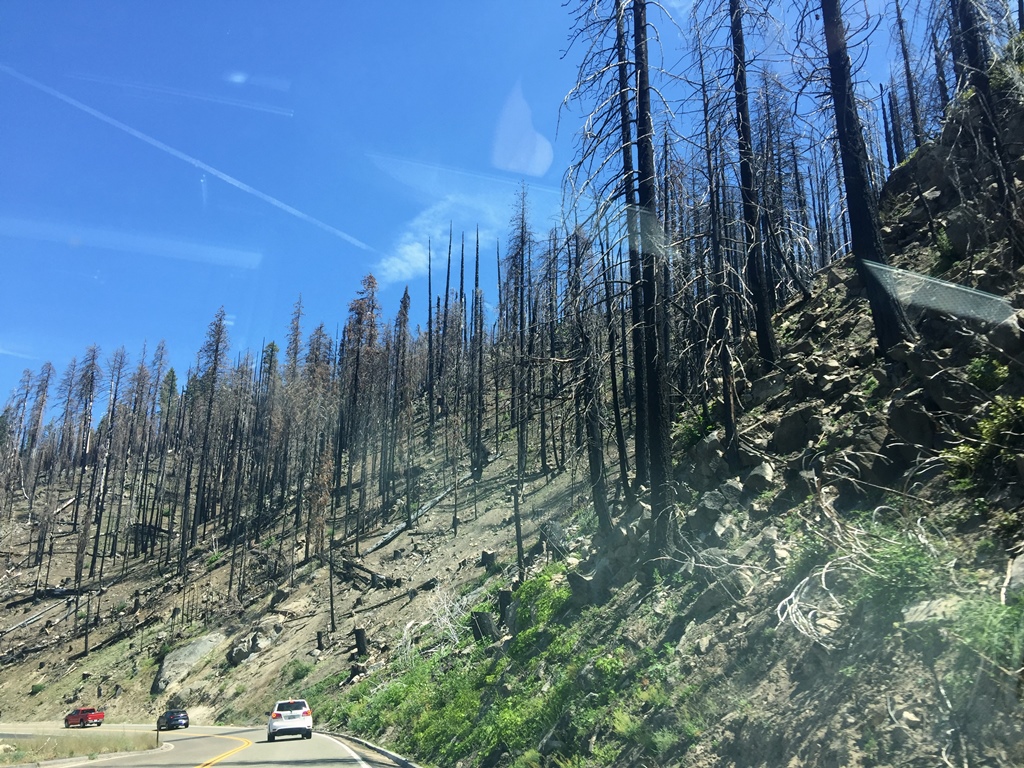
We entered the park through the south entrance, where we paid our entry fee. We
proceeded carefully along highway 41, passing through an area that had been
scorched by the previous year's fire.
Aftermath of 2018 Wildfire
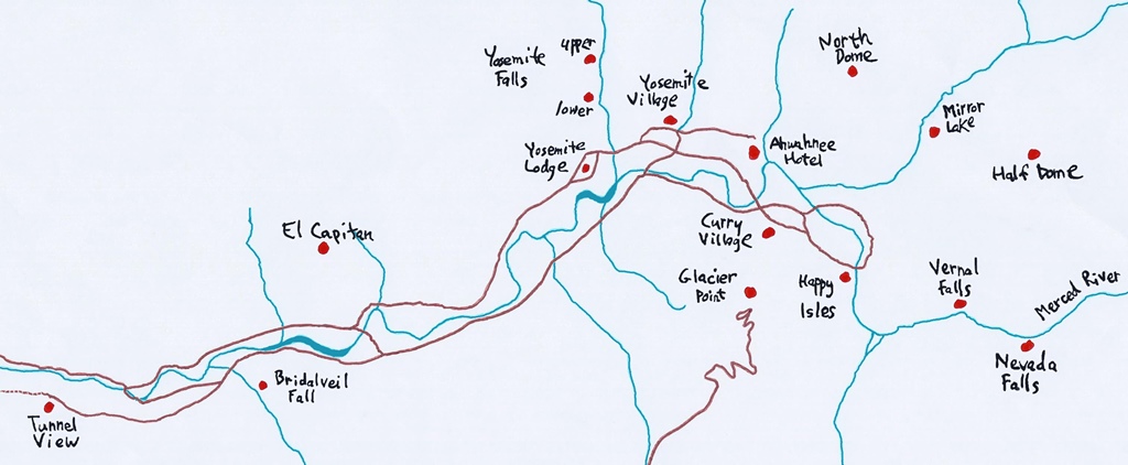
Our destination was in Yosemite Valley, an area which is only about seven miles
long and a mile wide, but which is ground zero for tourists (including us).
While the valley isn't very big in area, it's quite deep, being surrounded by
3,000-foot granite walls, and is home to most of the park's iconic sights.
When approaching the valley via highway 41, one passes through the Wawona tunnel,
a 4,200-foot-long tunnel (the longest highway tunnel in California) that was
blasted through the granite in 1933 (drive carefully – it's easy to lose track
of how steep the road in the tunnel is, and your speed can creep up). At the
end of the tunnel there is a parking area with a magnificent view of the valley
(again, drive carefully – drivers and pedestrians will be gawking and taking
selfies).
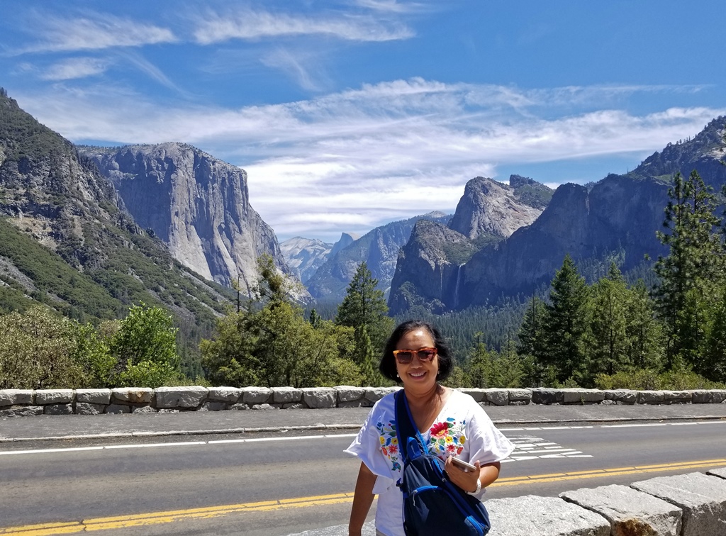
Nella and Yosemite Valley
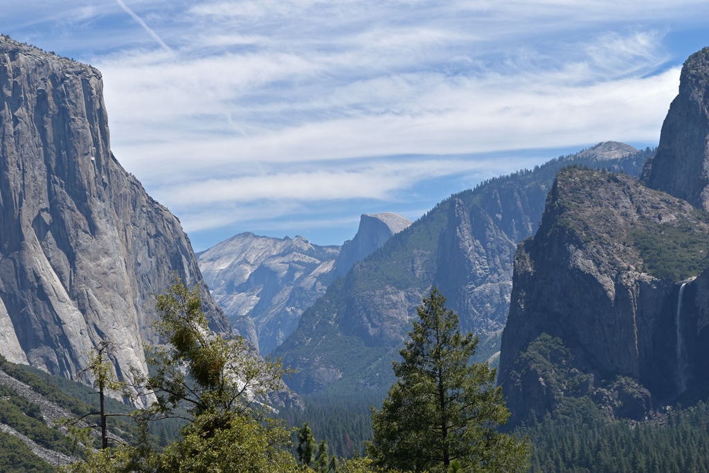
Yosemite Valley

El Capitan

Bridalveil Falls, Cathedral Rocks
Having taken our own pictures, we entered into the Yosemite Valley Metropolitan Area.
The roadways in this area can be tricky. Many of them are one-way, so it's important
to pay attention to the signs, so you don't end up heading in the wrong direction or
into traffic situations you'd rather avoid. And traffic can be significant in
certain areas, at certain times of the day. There are bus lanes you should stay out
of if you're not a bus, and at any time you can encounter drivers who are more
interested in the scenery than in their driving.
Yosemite Valley
We were headed to the easternmost and oldest accommodation in the valley, Curry
Village. Curry Village began in 1899 as Camp Curry, owned and operated by
entrepreneurs David and Jennie Curry, who had set up tents you could live in for
$2 per night. Much has changed over the years, but most of the accommodations
are still things called "tent cabins", which boast wooden floors and framework,
but whose walls and roofs are still made of canvas. But the rates have changed
somewhat – staying in a tent cabin starts at $84 per night as of the writing of
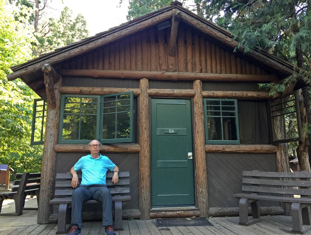
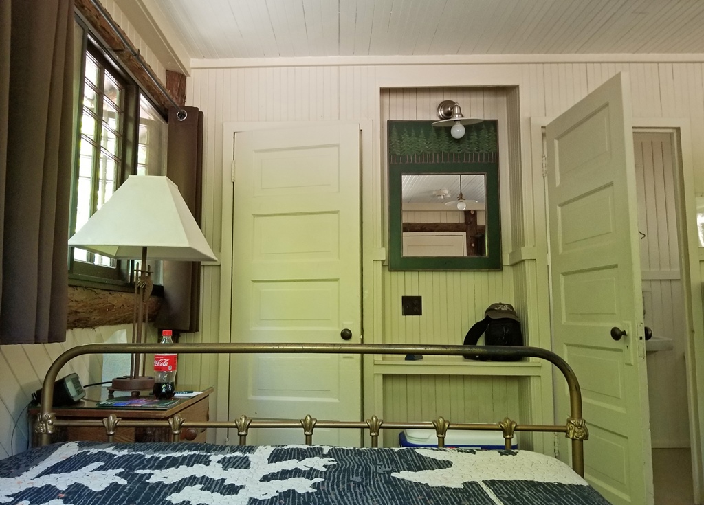
this page. We didn't stay in a tent cabin, but rather in a real cabin, with
wooden walls and its own bathroom (as alluded to above, there are very few of
these), which costs substantially more.

Curry Lounge Fireplace, with the Curries
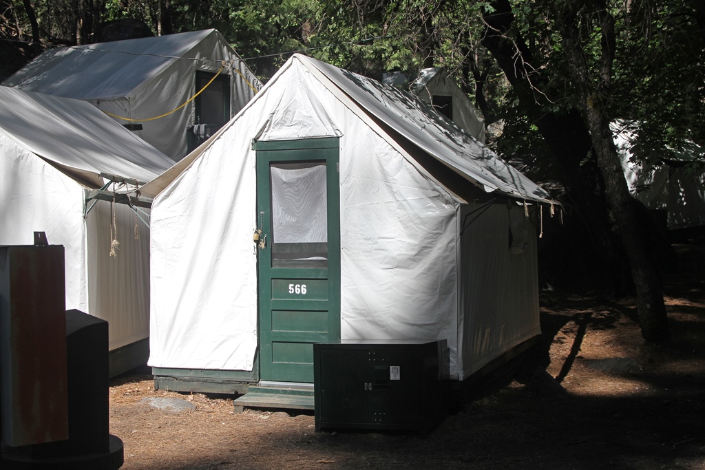
Tent Cabins
Our Cabin
In the Cabin
Cabin View - Half Dome with Tree in Front of It

Cabin View - Glacier Point with Tree in Front of It
Among the many other changes to Camp Curry, there have been some name changes. In
1970, Camp Curry became Curry Village. Then in 2015, the park jettisoned its long-time
concessionaire (the company that operates the accommodations), Delaware North, in favor
of a company called Aramark. Delaware North did not go quietly, claiming that their
previous contract had given them the rights to "intellectual property" connected with
the park, including the names of the accommodations. They wanted more than $50 million
to allow Aramark to continue using the old names. Aramark and the park service weren't
convinced about the intellectual property claim and began legal proceedings, but in the
meantime they changed the names of all of the accommodations in the park, to be on the
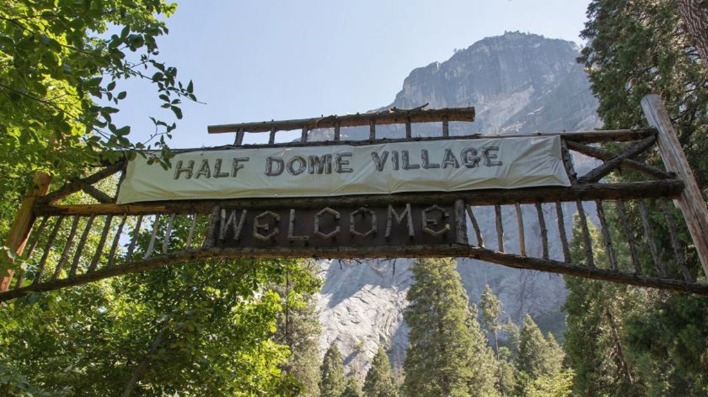
safe side. Among other changes, Curry Village became "Half Dome Village". Shortly
before our arrival in 2019, though, news was announced that a settlement had been
reached, and that Aramark and the park service would pay $12 million (mostly paid by
Aramark) for the rights to use the old names. Aramark seems to have been prepared for
this, and many changes back to the old names had already been accomplished by the time
we showed up. Some changes were easier than others – a gateway sign which had been put
up early in the 20th Century had been covered up with a tarp that said "Half Dome
Village", and removing the tarp no doubt only required a ladder and a few minutes.

Camp Curry Ad, 1921
Half Dome Village Sign
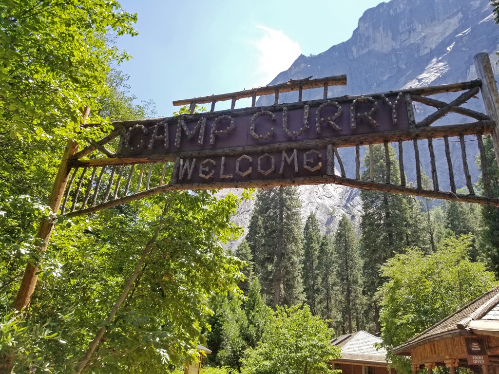
Camp Curry Again!
After relaxing at the cabin for a while, we went out in search of dinner. Curry has
a Dining Pavilion, a pizza stand and a burger stand, none of which appealed to us at
the time. We decided to check out the cafeteria at another accommodation, Yosemite
Valley Lodge. To get to the lodge, we needed to catch a ride on the free valley
shuttle bus. The only other options were walking (a few miles, longer than we had
time or ambition for) and driving (normally not recommended – finding parking can be
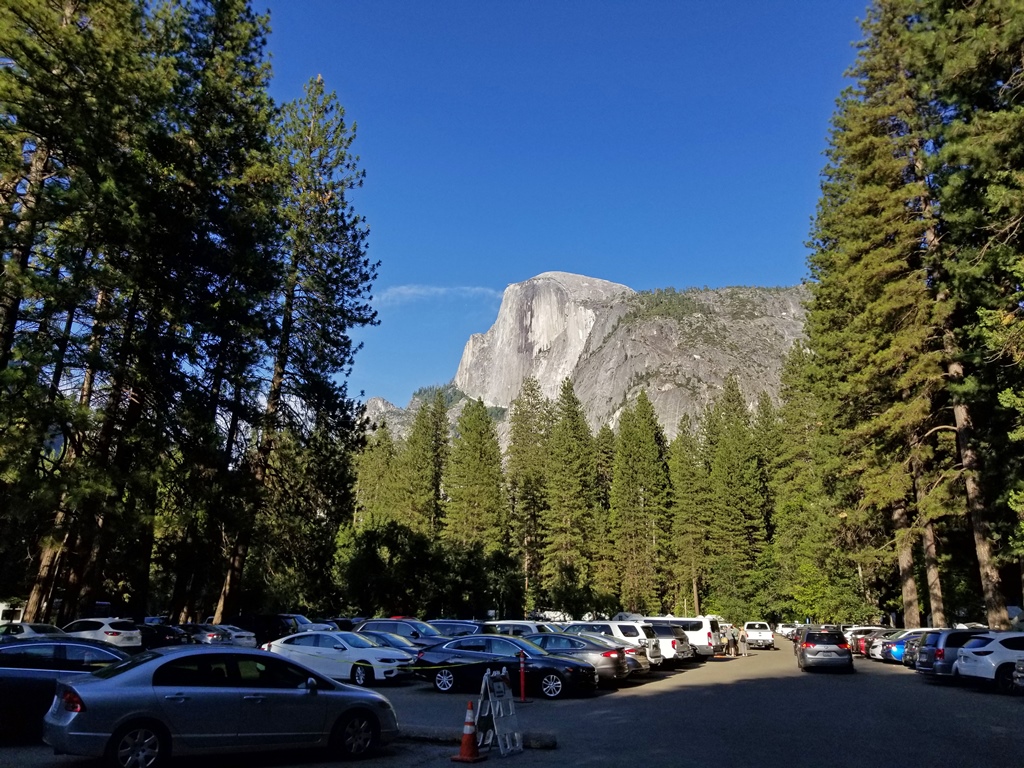
a nightmare). To get to the shuttle stop, we needed to walk through Curry's main
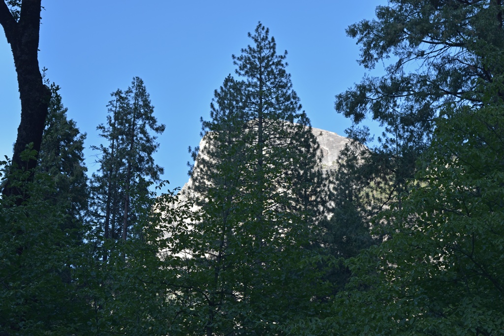
parking lot, from which there is a swell view of Half Dome, probably Yosemite's
best-known landmark.
Half Dome
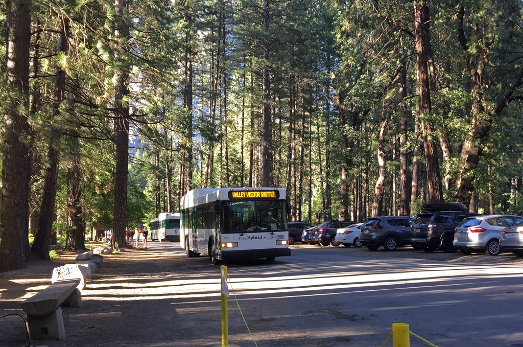
We walked over to one of the Curry Village shuttle stops (there are three) and
waited. And waited. Apparently there have been problems with the shuttle
system since Aramark took over. According to
a San Francisco Chronicle article
we found on the Internet, there have been fewer drivers, buses and mechanics.
And during our stay, there seemed to have been poor to nonexistent management
of bus separation – twice we had to wait well over half an hour for a bus, only
to have three buses arrive at once. Time between buses is advertised as 10-15
minutes, and we had this experience a couple of times, but it was not something
that could be relied upon. I guess you get what you pay for.
A Shuttle Bus
For distances of a stop or two, we ended up just walking most of the time. For
our trip to the Lodge, we ended up waiting about a half hour, but we did
eventually get a bus, which took us toward the Lodge. On the way, we had some
nice early-evening views of some of the valley scenery.

Sentinel Rock

Upper Yosemite Falls
Yosemite Valley Lodge, the westernmost accommodation in the valley, has also
undergone some name changes. It was originally called Yosemite Lodge, eventually
being renamed to Yosemite Lodge at the Falls. During the Delaware North dispute,
the Lodge was renamed to Yosemite Valley Lodge, and it seemed at the time of our
visit that they were going to keep the "temporary" name, rather than reverting to
one of the old ones. We found the cafeteria easily, but it looked very different
from previous visits we'd made to Yosemite. It’s been renamed to the Base Camp
Eatery, and instead of a standard cafeteria layout, there are now three "stations"
at which you can order different types of food. One of the stations has
touch-screen kiosks for ordering, but the others don't, at least not yet. The
food turned out to be pretty decent. After eating it, we caught a bus back to
Curry and retired for the evening.
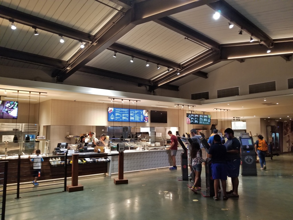
Base Camp Eatery

Yosemite Lodge Cafeteria (2011)
In the morning, we had breakfast at the Curry Dining Pavilion (pretty basic stuff,
but not bad) and set out to see Yosemite Falls, on foot. We started by crossing
the Merced River using Stoneman Bridge. It's possible to rent rafts that launch
from near this bridge, when the river level isn't dangerously high or impassably
low. But there are nice views from the bridge, regardless of the river's condition.
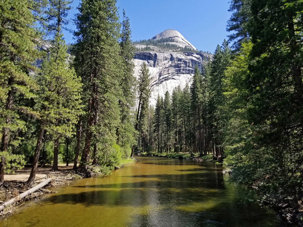
North Dome, Merced River
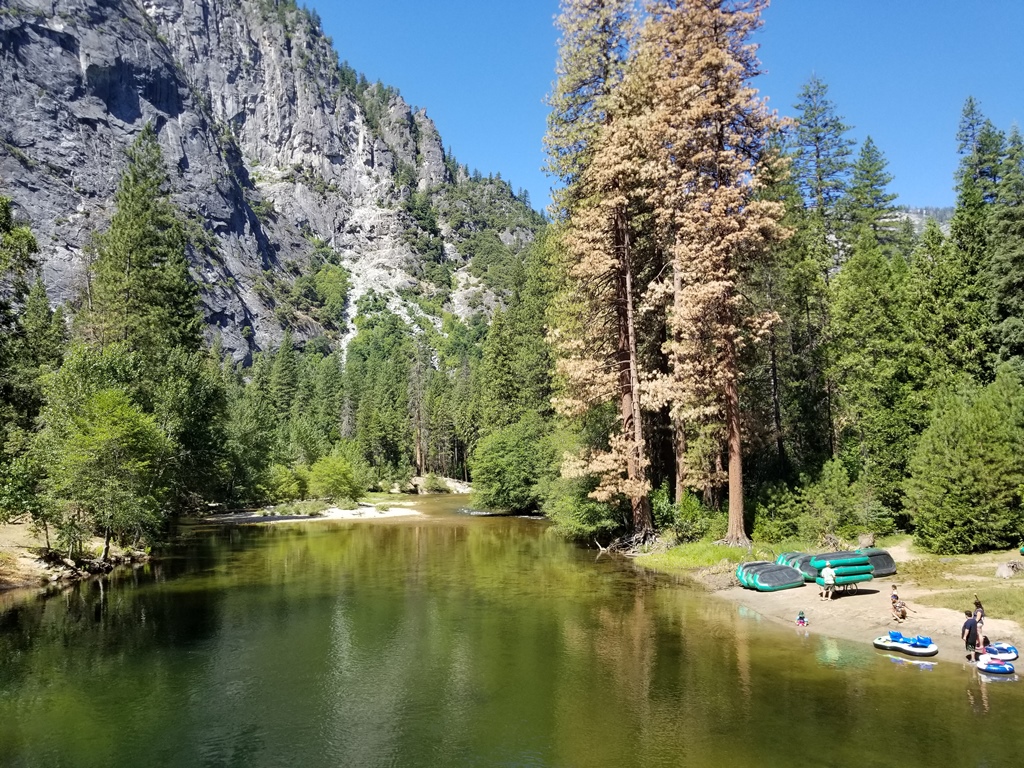
River and Raft Launching Point
We continued on the path that ran next to the road, occasionally moving to the
side to avoid bicycles. After passing through Yosemite Village, we reached a
point where the pathway departs from the roadway and heads toward the base of
the falls.
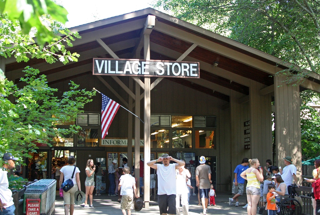
Yosemite Village Store
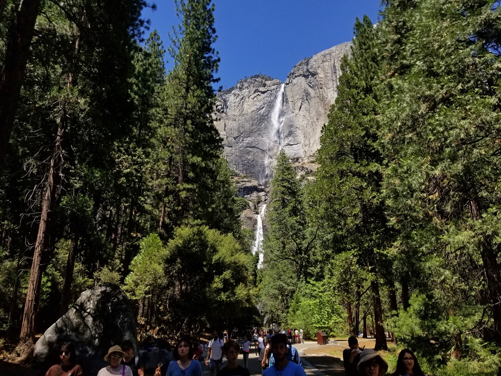
Yosemite Falls, at 2425 feet, is the tallest waterfall in North America. It's
helpful to think of the waterfall as consisting of three sections: the upper fall
(1430 feet, the most visible section), the lower fall (320 feet) and a middle
cascade area (675 feet, not visible from the valley floor). During dry years or
late in the summer, the falls can be reduced to a wet spot on the rocks, but the
winter of 2019 was relatively wet, so we still had a respectable waterfall to look
at. Our pathway eventually led to a footbridge over Yosemite Creek (Yosemite
Falls after it falls), from which there is a good view of the lower fall. The
bridge isn't that close to the waterfall, but it's close enough to experience
some spray. Many people crawl around on the rocks between the bridge and the
waterfall to get closer to the lower fall, but this isn't recommended, as the
rocks can be slippery even when dry, and many injuries are sustained in this area
each year.

Lower Yosemite Falls (0:34)
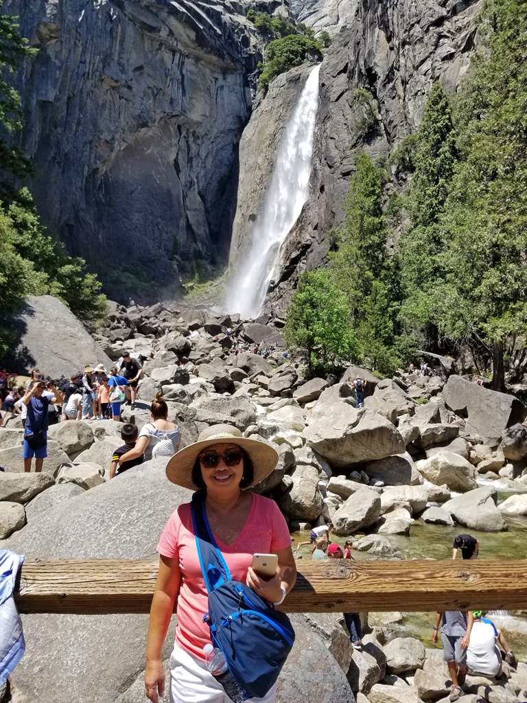
Nella and Lower Yosemite Falls
Leaving the bridge, we followed a paved trail back toward the road. There is a
point along the trail where the upper and lower falls are both visible.
Upper and Lower Yosemite Falls
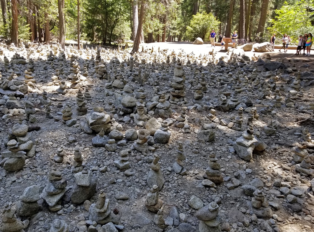
Also along the trail, there is a place where many stacks of rocks have been created
by enterprising tourists. Not exactly a natural formation, but it has an interesting
look.
Many Stacked Rocks
We returned to Yosemite Village, where there is a visitor center, and we looked
through the informative exhibits. At one point there is a bronze sculpture of John
Muir, the 19th-20th Century naturalist and author who co-founded the Sierra Club
and who was very influential in the addition of many wilderness areas (including
Yosemite) to the National Park system.

Visitor Center
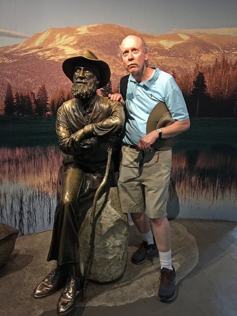
Bob and John Muir, Gazing at … Something
Becoming low on energy by this time (the 4,000-foot altitude of the valley was
taking its toll), we were able to catch a bus back to Curry Village, where we
found lunch and then relaxed in the cabin for the rest of the day.
The next day we were feeling more acclimated to the altitude, so we resolved to
try something a little more ambitious – an ascent to the top of Vernal Falls.
Vernal Falls is a waterfall past the eastern end of the valley which has a
height of 317 feet, which would make it impressive in nearly any location
besides Yosemite. At 3 miles for the round trip, the Vernal Falls hike is
one of the shortest in or around the valley. However, it is rated as
"strenuous", for reasons that will become apparent.
The trail to Vernal Falls starts at the Happy Isles shuttle stop, which is
located near a bridge over the Merced River. To get to the trail, one must
cross the bridge on foot after getting out of the bus. At this point the
river is too fast, shallow and rocky for any attempt at navigating it, but
there is a nice view of it from the bridge.

Merced River Near Happy Isles (0:31)
On the far side of the bridge, we turned left and followed a pathway that
followed the river. It's difficult to get lost at this point, as many other
people will be taking the same path. The trail to Vernal Falls is also the
beginning of much longer hikes to points around the valley and beyond. This
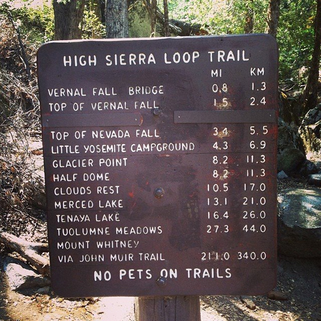
is in fact the beginning of the John Muir Trail, a 213-mile-long trail that
ends at the 14,000-foot summit of Mt. Whitney, in Sequoia National Park to
the south. Our effort would be a minimal stroll by comparison. But we
planned on feeling like trailblazing explorers. And we would be back by
lunchtime.
The trail veered away from the river and became paved, disturbing our
illusion somewhat. It also started to become steeper. Most of the trail
had at least some shade (welcome, as the temperature was approaching 90
degrees), but in places where there were breaks in the tree cover, we were
treated to some amazing views.
Sign at Beginning of Trail

Nella on Trail to Vernal Falls

Photobombing Squirrel
The trail continued generally uphill until we reached a point where the trail
crossed to the other side of the river via a footbridge. From the bridge we had
a good, close look at the river and also had our first look at Vernal Falls in
the distance.

Water Near Vernal Falls Bridge (0:30)

Water Near Vernal Falls Bridge (0:34)
Vernal Falls from Bridge
On the far side of the river there were some drinking fountains and faucets for
refilling water containers. This is the last point on the trail where piped-in
drinking water is available. Beyond this point, water must be obtained from rivers
and streams, and should be filtered or otherwise purified before being consumed.
The trail also continues and is relatively flat for a little while. Then things
get interesting.
Before the bridge, the trail is generally uphill, and this, combined with the
altitude, can make it difficult for older people or people in poor physical
condition to reach this far. But the reason for the "strenuous" rating on this
trail comes after the bridge. While the distance from Happy Isles to the top of
Vernal Falls is only 1.5 miles (actually slightly less), there is an elevation gain
of 1,000 feet. Most of this elevation gain starts shortly after the bridge, when
the trail abruptly becomes so steep that it takes the form of an irregular granite
staircase, pretty much the rest of the way to the top. The trail is very crowded
along this stretch, and with the stairs narrowing to a couple of feet in places,
things can become awkward. It also doesn't help that there are no railings (except
for a short stretch near the top), and it quickly becomes a long way down to the
river on the left. The waterfall itself throws in a further complication, as it
generates a lot of spray that floats upward to the trail, saturating both the trail
and the people walking on it. This can actually feel pretty good on a hot day, but
can make for tricky footing (yes, people have fallen off this trail) and can be
hard on vulnerable electronic gadgets if they're not protected. This waterfall
effect gives this part of the trail a picturesque name – it’s called the "Mist
Trail".

Nella Climbing Mist Trail

Vernal Falls from Mist Trail (0:24)

Vernal Falls from Mist Trail (0:25)
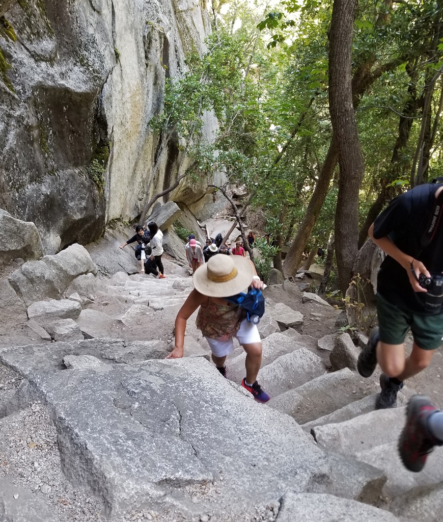
Nella Climbing Mist Trail
The last section of the trail hugs the cliff face (fortunately this is the part
with the railing) and ends at the top of a large expanse of granite that slopes
down to the top of the falls, where many tourists congregate. A railing runs
along the top of the cliff, and another separates tourists from the final cascade
taken by the Merced River before it launches itself over the brink to become
Vernal Falls. These railings should be taken extremely seriously. The railing
along the top of the cliff is there for obvious reasons (the view from this
railing is magnificent). The railing along the river might be less obvious – the
water is moving fast, but it's pretty shallow, and there's a little island a
short distance from the edge of the water. One might be tempted to hop over the
railing and wade out to the island to pose for the best photo ever. But
thousands of years of rushing water have worn the rock to a lovely smoothness,
and if you're attempting to walk across it when it's wet, you might as well be
ice skating. Throw in the strong current, and you have a recipe for an
unsurvivable 317-foot fall onto jagged rocks, and a worst-possible conclusion to
your Sierra Nevada vacation. This is not just a thought experiment – this exact
thing has happened several times, and has happened
as recently as 2011,
at this very spot, when three young people lost their lives. When visiting
Yosemite, it's best to remember that it’s a National Park, not an amusement park,
and there is no end to the ways in which you can hurt yourself.

Top of Vernal Falls (0:44)
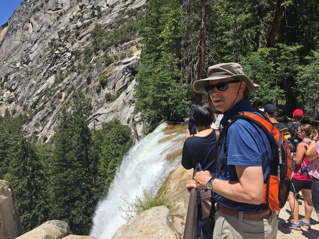
Bob at Top of Vernal Falls
But it's undeniably a beautiful National Park, and we spent some time marveling
at the scenery before walking a little ways upstream. Above the final cascade
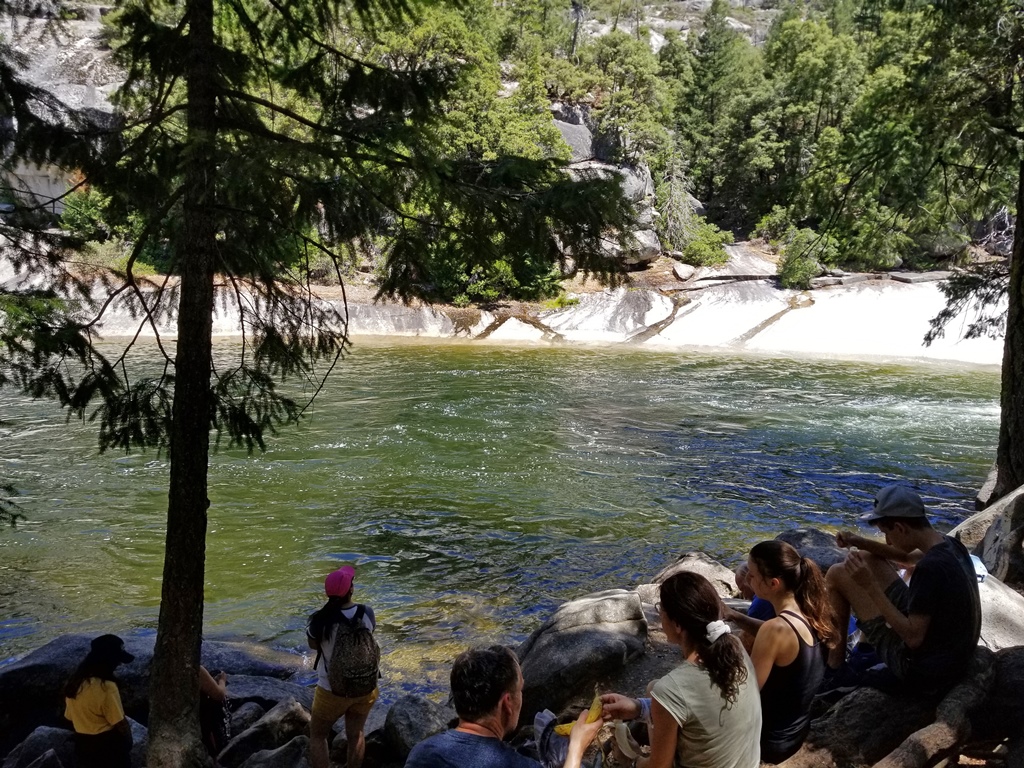
to the waterfall there is a large, deep green pool which is called the Emerald
Pool. There is no railing around it, but there are "no swimming" signs. Since
the Emerald Pool feeds directly into the final cascade before the waterfall,
swimming in it should be an obviously bad idea to most people. And above the
Emerald Pool there is an expanse of granite with a sheet of fast water rushing
across it. The water explodes out of a gap between some rocks upstream and
shoots down the granite expanse (called the "Silver Apron") before feeding into
the Emerald Pool. Again, there are no railings, but fooling around on the
Silver Apron is another epically bad idea.
Emerald Pool

Silver Apron (0:47)

Violent Water
Upstream from Vernal Falls, there is another, taller (594 feet) waterfall called
Nevada Falls. A continuation of the Mist Trail can take you an additional two miles
to reach the top of Nevada Falls, but we weren't feeling that ambitious. In fact,
we didn't really feel like going back down the crowded, wet Mist Trail to go back
where we'd come from. Fortunately there is another way, though it involves more
walking. The Mist Trail is not a part of the John Muir Trail. Shortly after the
bridge with the drinking fountains there is a fork in the trail for the John Muir
Trail. The John Muir bypasses Vernal Falls and goes directly up to the top of
Nevada Falls. But at the top of Vernal Falls there is a side trail which goes up
about a half mile to meet the John Muir, and this is what we decided to do. This
side trail is steep and very rocky, and is hard on the feet, leading us to have some
second thoughts. But we persevered. There was a spot which looked down on Vernal
Falls, which was an interesting vantage point, and there was another spot with a
nice view of Nevada Falls, which you can't really see from the top of Vernal Falls.

Vernal Falls (0:46)

Nevada Falls
We eventually reached the John Muir Trail, where there was a fork with a sign
indicating directions for Nevada Falls and for the valley floor. We took the valley
floor direction. The sign indicated the valley was two miles away. This trail was
long, rocky and switchbacky, and was also hard on the feet, but we eventually got
back to the footbridge, and then continued down to Happy Isles. We thought we might
take the shuttle bus back to Curry Village, but when we got to the bus stop, there
was a long line of people already waiting (apparently no busses had stopped in a
while). It seemed that we would be waiting a long time before we could get on a bus,
so we checked the sign on a footpath to see how far away Curry Village would be on
foot. The sign said 0.4 miles, and we knew from previous experience that the trail
was flat and non-rocky, so we decided to walk back to Curry. Our trail ran
alongside the road that the shuttle busses used to reach Happy Isles, but during our
entire walk back to Curry, we didn’t see any busses taking it. We had to conclude
that the people waiting at the Happy Isles stop had to wait an extremely long time.
Maybe they're still waiting.
By the time we got back to the cabin, we were ready to take a rest, but we dropped
off our stuff and headed for the burger stand, as it was now mid-afternoon and we
were starving. After eating, we returned to the cabin and collapsed for a while.
Our planned 3-mile walk had turned into a rocky 5-mile walk with a 1,500-foot
elevation gain, and we had lost all interest in doing anything but resting our sore
feet. But eventually it was dinnertime, and we roused ourselves enough to get to
the shuttle stop. Our plan was to go to The Loft, a restaurant in Yosemite Village.
As usual, we had a nice, long wait for a bus, but it turned out not to be a complete
waste of time, as we were paid a visit by some of the local fauna. Apparently deer
like to appear in the meadows in the early evening.

Deer Here (0:27)

The Loft
The Loft serves an eclectic mix of Asian bowls, Mexican food and pizza. We settled on Mexican,
which turned out to be better than expected, and were able to get out of the restaurant before
closing time. We caught the bus back to Curry (a surprisingly short wait this time) and shut
down for the night.
The next morning we took the shuttle bus to the Ahwahnee Hotel for breakfast. It's the park's
classy destination, where celebrities, heads of state and sundry rich people stay when they're
in the park. It opened in 1927, having been built by the Yosemite Park and Curry Company (an
entity formed when the Curry Company, owners of Camp Curry, merged with the Yosemite Park
Company, owners of Yosemite Lodge). During the Delaware North dispute, the hotel was
temporarily renamed to the Majestic Yosemite Hotel, a movie theater of a name that was
mercifully dropped when the dispute was settled. The hotel has a massive dining room which
seats 350 people, which is where we went for breakfast. Nella wasn't very hungry and stuck
with oatmeal and a side of corned beef hash. I ordered a cinnamon apple flapjack (with
raspberry purée), one of the hotel's specialties. After breakfast, we hung out in the hotel's
guest lounge for a little bit.
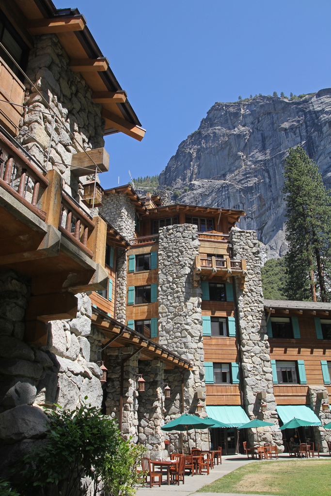
Ahwahnee Hotel

Ahwahnee Hotel Welcome Mat
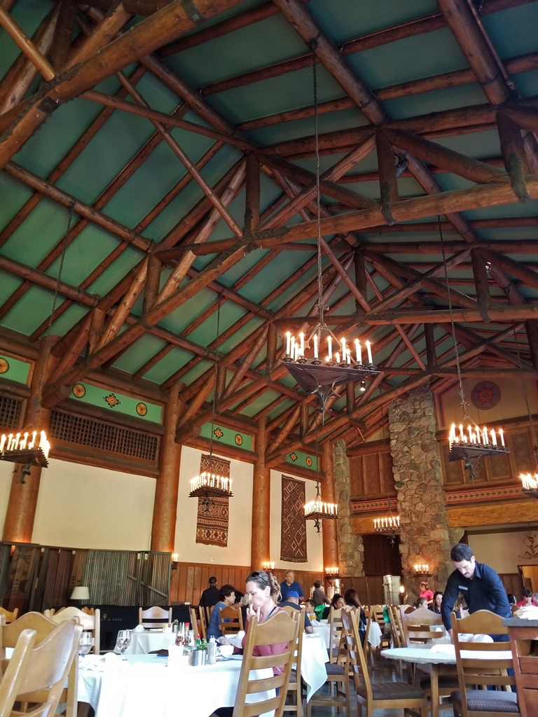
Ahwahnee Hotel Dining Hall
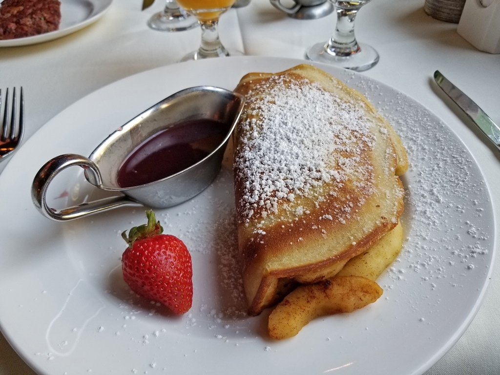
Cinnamon Apple Flapjack
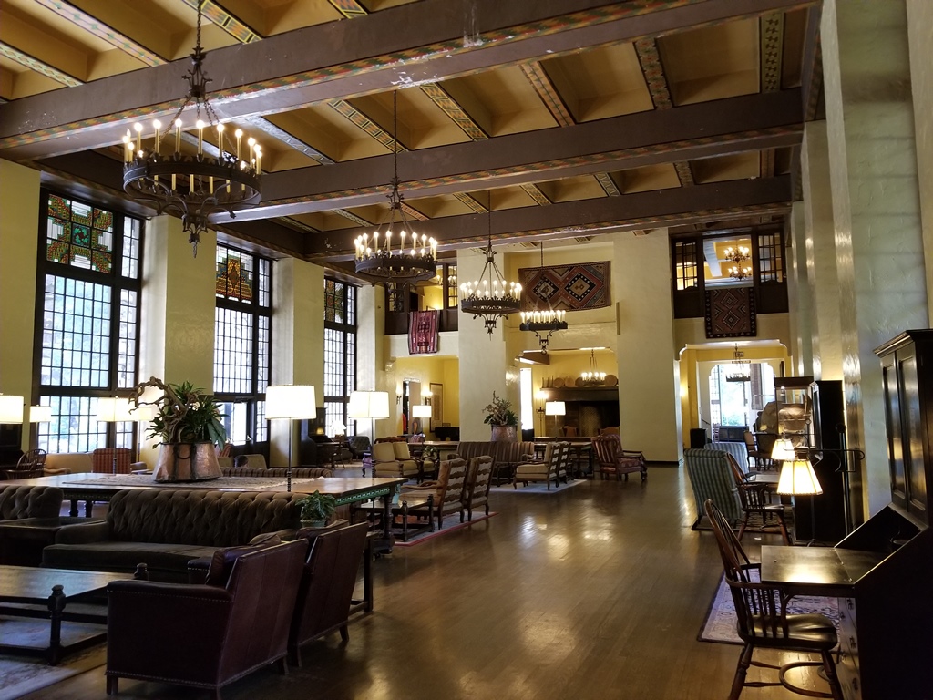
Guest Lounge, Ahwahnee Hotel

Bob and Fireplace, Guest Lounge
Next we continued on our adventure for the day. This was an adventure that didn't involve
hiking, but it did involve leaving the valley. This meant we had to get back in our car
and do some driving. This was good, because we wouldn't have to rely on the dysfunctional
shuttle bus system to get anywhere. But it was also not so good, because it meant we
would have to find parking if we wanted to stop anywhere (which was the whole point of
driving out of the valley). Parking at popular locations in Yosemite in the summer
involves either a lot of luck or a lot of patience. We were headed for Glacier Point,
which is most definitely a popular location, and would need both luck and patience as it
turned out.
First we needed to get out of the valley, which involved driving out past El Capitan. El
Capitan is a large granite formation which rises 3,000 feet above the valley floor, and
which is something of a Mecca for climbers. "El Cap" has been climbed many times, by
many routes, and people have also BASE jumped from the summit (a practice that has been
outlawed). And yes, there have been fatalities (more than 30 since 1905).

El Capitan
The road to Glacier Point is a turnoff from the road we'd used to get to the valley
from Fresno, meaning we had to go back through the Wawona Tunnel to get to it. The
Glacier Point road is scenic in its own right, and has more twists and turns than the
main road, especially as it approaches the parking area for Glacier Point. And for us,
the traffic was backed up entering the parking area, indicating that parking spaces
were at a premium. But eventually someone vacated a spot at just the right time, and
we were able to get parked ourselves.
Glacier Point is less than half a mile from Curry Village, horizontally. But
vertically, it's about 3,200 feet higher. Visitors to Glacier Point are treated to a
spectacular bird's-eye view of the eastern part of the valley and some of the high
country beyond. Points of interest that can be seen include Half Dome, Nevada and
Vernal Falls, Tenaya Canyon, North and Basket Domes, Yosemite Falls, Curry Village,
the Ahwahnee Hotel and Yosemite Village. You might think this would be a great place
for a hotel, and in fact there was a hotel on this spot from 1918 until 1969, with a
viewing porch. But the hotel was damaged by heavy snowfall in the winter of 1968-69,
and it was destroyed by an electrical fire the following summer. The park service
disallowed the rebuilding of a hotel in the same place. Today, facilities in the
Glacier Point area consist of a store, some bathrooms with pit toilets adjacent to
the parking area, and a small geology exhibit.

Glacier Point Hotel
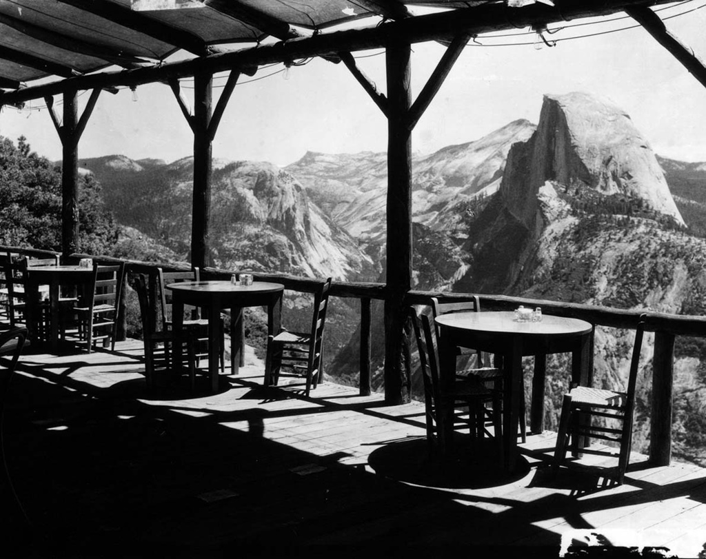
Viewing Porch
And there has been quite a bit of geology going on in this area. It's thought that the
granite in the area was formed deep underground many millions of years ago, back around
the age of dinosaurs. Then it was gradually uplifted to the surface, where erosion
started working on it. Yosemite Valley is thought to have been a result of water
erosion, plus widening by glaciers which filled the valley during a series of ice ages,
the most recent of which ended about 11,000 years ago. The result is a view which is
breathtaking for most, but disquieting for those who are nervous about heights.
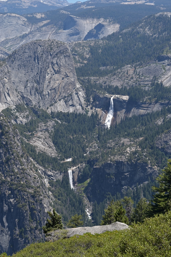
Nevada and Vernal Falls from Glacier Point
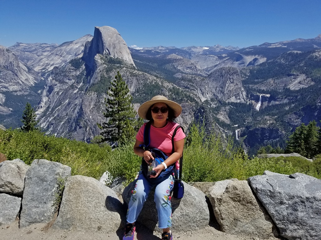
Nella with Half Dome, Nevada and Vernal Falls
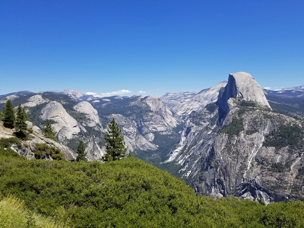
North Dome, Basket Dome, Half Dome, Tenaya Canyon

Top of Half Dome
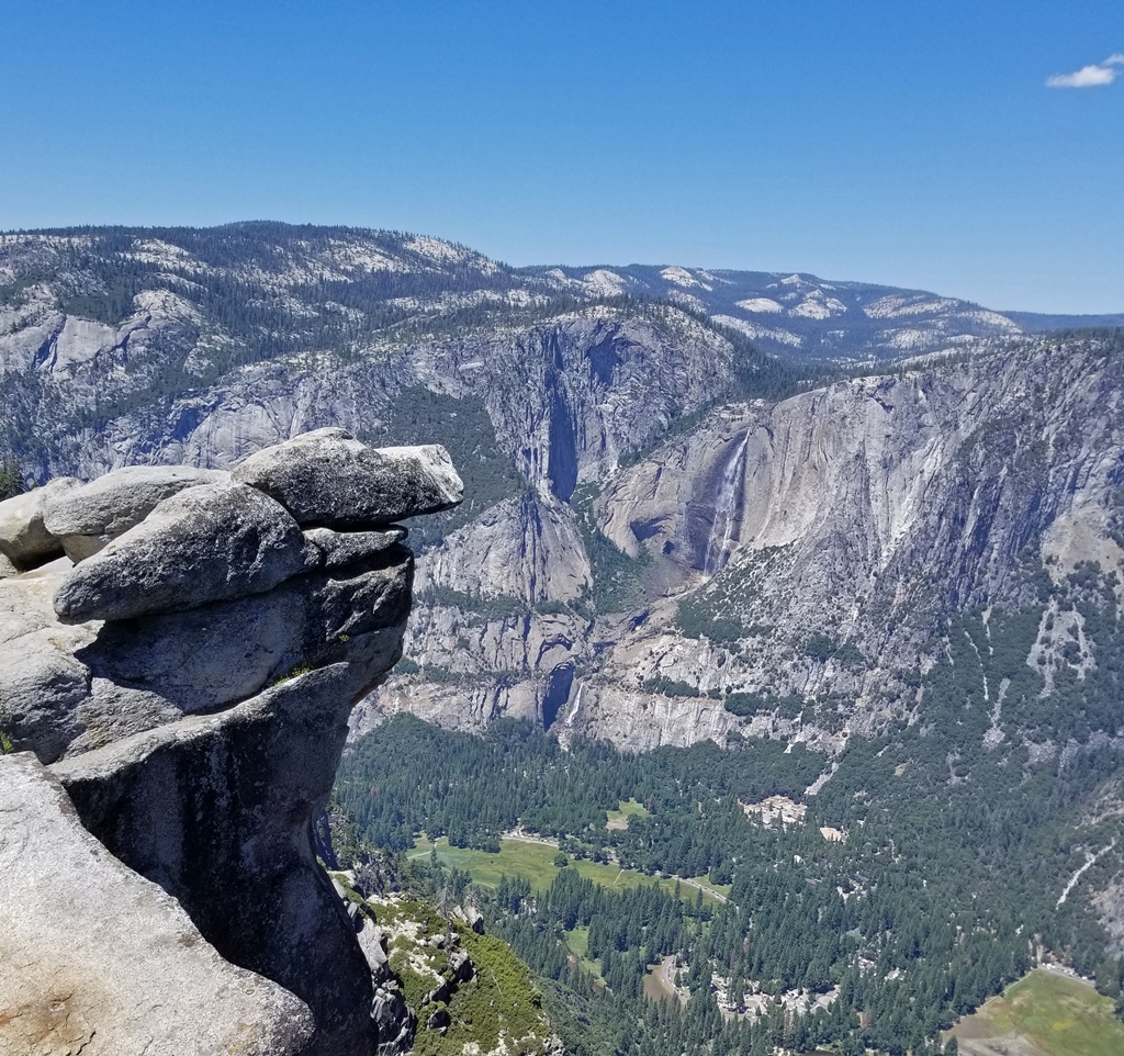
Yosemite Falls with Overhanging Rock

Yosemite Falls from Glacier Point (0:58)

Curry Village from Glacier Point
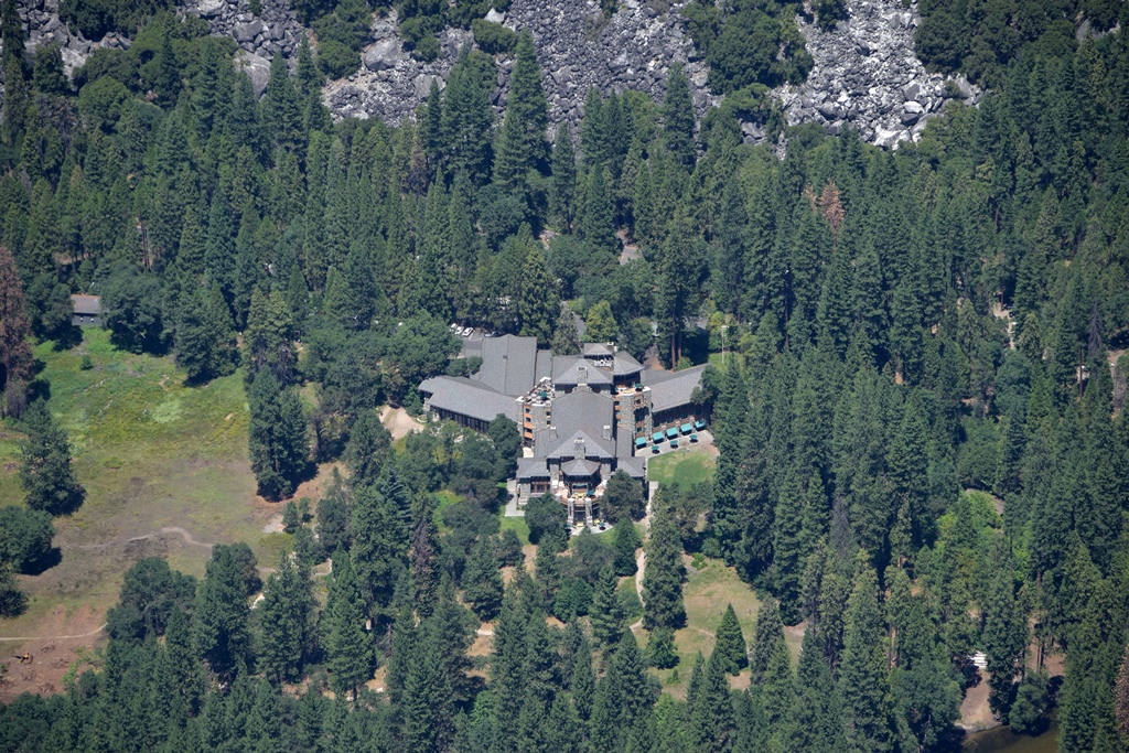
Ahwahnee Hotel from Glacier Point
After getting our fill of the view, we returned to our car, vacated our spot for an
undoubtedly grateful fellow tourist, and returned to the valley. On the way, we passed
through the tunnel again and also passed a spot there was a nice view of Bridalveil Falls.
Bridalveil Falls
We had thoughts about parking at Yosemite Village and picking up sandwiches, but we gave
up on finding a parking place at the Village after looking for an extended period (this
time we did not get lucky). We returned to Curry Village and found parking in the guest
area, and we began preparing for our departure from the park, which we'd be doing the
next day. While make our preparations, we paused to look at the pictures we'd taken on
this trip, and thought about some of the things we'd like to see some day. Maybe the
Hetch Hetchy Valley (now a reservoir) in the north, or Tuolumne Meadows on the road over
Tioga Pass, or one of the Sequoia Groves in the park. But the next day we would be
required to vacate the premises and drive back to SoCal. So maybe next time.


